Wetland Health Evaluation Program (WHEP)

Wetlands Monitored

Home
Why Wetlands?
What is an IBI?
Invert. Sampling (spineless critters)
Vegetation Sampling
Get Involved
Testimonials
Training and Events
Resources and Presentations
Wetlands Monitored
WHEP Mapper (Dakota County)
WHEP Reports and Data
Frequently Asked Questions
Contact Us
Links
Wetlands come in many different shapes and sizes, as well as types.  They all vary in the amount of water they hold, how long they hold water, and the type of vegetation they support.  Not all wetlands have standing water during the growing season.

All wetlands must meet three criteria: 
1.  soils developed in wet conditions
2.  they are wet either above ground or
     wet within 12 inches of the surface
     during all or part of the growing season
3.  they have plants adapted to live in wet
     soil conditions

The U.S. Fish and Wildlife Service divided wetlands into 8 types (Types 1-8).  The two primary characteristics used in the classification system include the wetland's dominant plant type and water depth during the growing season.  Wetlands monitored 
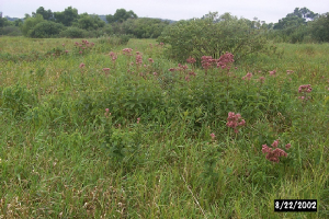
in WHEP are depressional wetlands with emergent marsh vegetation (Types 3, 4, or 5).  

The Minnesota Pollution Control Agency has designed and tested the WHEP sampling protocols for Type 3, 4 and 5 wetlands located in the Central Hardwood Region of the State of Minnesota. 
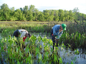
Wetlands sampled in WHEP are chosen by the sponsoring agency (City, Watershed Managment Organization, Park Board etc.).  

Select the wetland in the list below to see a map to that wetland. Each wetland monitored in the current program year are included in the list. 

2007 Wetlands Monitored in Hennepin County
 

Bloomington-2007 (409 KB)

Eden Prairie-2007 (418 KB)

Maple Grove-2007 (369 KB)

Minneapolis-2007 (570 KB)

Minnetonka-2007 (478 KB)

Watershed Team (Brooklyn Park, Champlin, Plymouth)-2007 (516 KB)

Type 2 Wetland
type_2_wetland.jpg

Type 3 Wetland
plantsid.jpg

2008 Wetlands Monitored in Dakota County
Apple Valley

AV-1, Hidden Valley, EVR-P53

AV-12, EVR-P12, Public Water 19-225W

AV-13, EVR-P14

AV-14, EVR-P43, Apple Valley East Park

Burnsville

B-1, Crystal West

B-2, Cam Ram

B-3, Kraemer

B-6, Alimagnet Dog Park

Eagan

Directions to Eagan WHEP Sites 2008

E-10, Cedar Pond

E-21, FP-11.5

E-22, FP-11.6

E-25, FP-4.5

Farmington

F-1, Pine Knoll

F-3, Kral Pond

F-4, Lake Julia

F-5, Pilot Knob

Hastings

Maps to Hastings Wetlands

H-4, Stonegate

H-6, Rebecca

H-30, Sand Coulee

H-56, 180th Street Marsh

Lakeville

L-4, Water Treatment Wetland Bank

L-7, DNR #387

L-8, DNR #393

L-9, NC-54 P.K. Wetland

Mendota Heights

MH-2, Copperfield

MH-13, PAR 3

Rosemount

map to 2008 sites only

map to all Rosemount sites

R-1, WMP 362

R-10, WMP 206

R-18, WMP 279

R-19, WMP 340

R-14, WMP 379 **alternate only

Wetland Health Evaluation Program